


aPhoto GPS Marker
*** WE RECOMMEND you to check our other application, "1ST PHOTO MARKER". This application is dedicated to similar tasks, but has improved user interface and suggests additional functionality for the same price.
***
aPhoto GPS Marker places text labels over the images, taken with iPhone built-in camera.
Following label types can be used:
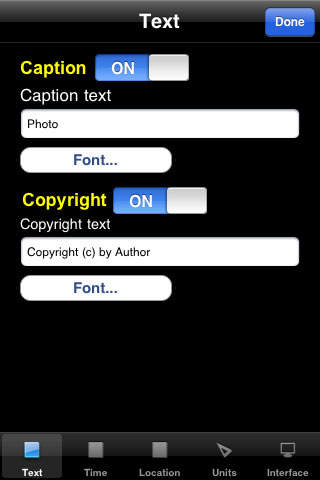
- Image caption (trip description, person name, etc. );
- Address (country, city, street name. Application is using Google service to convert coordinates into address string, so internet connection is required for this feature).
- Current date and time (short, medium and long formats);
- Geographical location - altitude and longitude;
- Distance to the selected location (distance to home, country capital, trip start);
- Altitude in meters or feet;
- Current speed (kmh, mph, knots);
- Copyright string;
Application uses built-in GPS to get the location data. You can enable or disable some labels, specify the font name, size, color or transparency for each label.
After the labels are placed, you can save it into your Photos album.
Separate screen with satellite data allow to use this program as a simple GPS.
Thanks to everyone for your suggestions about additional functionality! THE BEST AND FASTEST WAY CONTACT US IS SENDING YOUR REQUESTS AND BUG REPORTS to [email protected]. WE ARE REALLY INTERESTED IN DIALOG, what is not possible when you leaving the bug-report as AppStore review.